- Date
- April 2, 2017, 15:28 local (22:28 UTC)
- Place
- Brinnon, WA
- Injuries
- 2 serious
- Damage
- Substantial damage
- Phase of flight
- Maneuvering
- Aircraft
- N167CBCirrus Design SR22
- Defining event
- Maneuvering: Controlled flight into terr/obj (CFIT)
- Weather
- Visual (VMC) · Day
- Status
- Completed · report August 10, 2020
- Report
- Approved by Office Director
- NTSB office
- Western Pacific Region
- Parties
- Federal Aviation Administration, Cirrus Aircraft, Continental Motors Inc.
- FAA report
- 20170402002259A
- Case key
- 94961
From the NTSB’s public API. By law, NTSB reports can’t be used as evidence in lawsuits over the accident.
On this page
Probable cause
The flight instructor's decision to fly into a valley without ensuring adequate clearance to avoid the rising terrain.
Findings · 3
NTSB’s coded findings. Those marked are part of the probable cause; the rest are factors or other findings. Under each, the cases with the same finding.
Sequence of events
The events NTSB coded, in order, by phase of flight. The defining event is the one that best describes the accident. Under each, the cases with the same event anywhere in their sequence.
Analysis
The flight instructor and student pilot departed on a planned 3-hour instructional flight. While en route, the flight instructor stated that he wanted to show the student that there was more to flying than just training and that flying was also "fun." The pilots subsequently turned the airplane toward a large river valley in mountainous terrain. The pilots flew into an area of rapidly rising terrain and realized they needed to climb to avoid terrain. The flight instructor applied full power and pitched the airplane up into a climb; however, the terrain rose faster than the airplane was climbing. The flight instructor instructed the student pilot to start a right turn. Shortly thereafter, he felt the turn was too slow, and he took control of the airplane. The flight instructor stated that things were happening too fast for him to recover the airplane. The airplane subsequently impacted terrain in a box canyon, with ridgelines between 100 feet to several hundred feet higher than the accident site. Postaccident examination of the airframe and engine revealed no mechanical malfunctions or failures that would have precluded normal operation.
Factual narrative
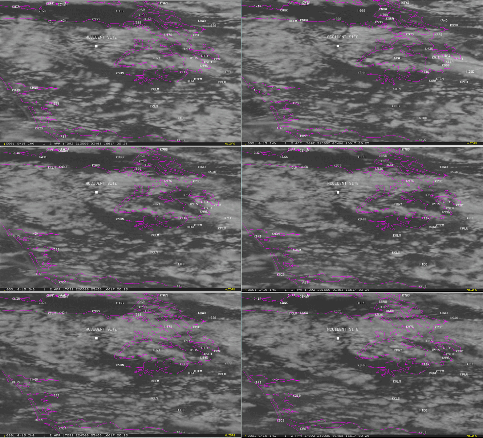
The FAA's Aviation Safety Program publication "Tips on Mountain Flying," section on ridge and pass crossing, states that "experienced pilots recommend crossing a ridge line or pass, at the ridge elevation plus at least 1,000 ft. The publication also states, "plan to be at that altitude at least three miles before reaching the ridge." The airplane's turn performance was evaluated using a performance chart from the Aerodynamics for Naval Aviators, NAVAIR 00-08T-80 publication. Based on 30° of bank, the performance chart indicated that the accident airplane would have about an 1,500 ft turn radius. A review of the accident area indicated only about 1,000 ft between the higher terrain on each side of the airplane, was available to complete a turn away from the high terrain in front of the airplane. Additionally, during the first half of the turn, the terrain continued to rise. The low-wing airplane was manufactured in 2004. It was powered by a 310 horsepower Continental IO-550 series engine that drove a three-bladed Hartzell constant speed propeller. A review of maintenance logbooks revealed that the airplane's most recent annual inspection was completed on July 30, 2016, at a Hobbs time of 841.6 hours. The flight meter read 557.1 hours at the accident scene; the Hobbs meter read 1,082.4 hours at the accident site. The Pilot's Operating Handbook listed the airplane's rate of climb at 6,000 ft pressure altitude and 98 KIAS to be about 1,046 ft per minute at 0° C. On April 2, 2017, about 1528 Pacific daylight time, a Cirrus Design Corporation SR22, airplane, N167CB, was substantially damaged when it impacted mountainous terrain near Brinnon, Washington. The flight instructor and the student pilot sustained serious injuries. The airplane was operated as a Title 14 Code of Federal Regulations Part 91 instructional flight. The cross country flight departed from Whidbey Air Park (W10), Langley, Washington, about 1500 with a planned destination of Bremerton National Airport (PWT), Bremerton, Washington. According to the flight instructor, they had planned a 3-hour instructional flight and planned to accomplish their traffic pattern work at PWT. While enroute, the flight instructor stated that he wanted to show the student that there was more to flying than just training. In his words flying was also "fun." Subsequently, the airplane was turned west towards a large valley in the Olympic Mountain range. While flying in the valley, the flight instructor stated that he believed their altitude was at least 2,000 ft above ground level (agl) and that no wind or turbulence was present. However, at some point, the pilots realized they needed to climb to avoid terrain and the flight instructor applied full power and pitched the airplane up into a climb. However, he realized that even with these control inputs, the terrain was rising faster than the airplane was climbing. The flight instructor instructed the student pilot to start a right turn. Shortly thereafter, hefelt the turn was too slow and just as the student pilot was increasing the bank of the turn, he took control of the airplane. The flight instructor stated that things were happening too fast for him to recover the airplane and he knew that they were going to crash. Subsequently, the airplane impacted terrain. The accident airplane was equipped with an Avidyne Primary Flight Display that contained two flash memory devices. The flash memodevices were recovered from the accident airplane and sent to the National Transportation Safety Board's Vehicle Recorder laboratory for download. The downloaded files captured the accident flight. The data started with the airplane flying southwest over Puget Sound, about 1,700 ft mean sea level (msl). At 1518, the airplane turned left to a south-southwesterly heading. At 1520, the airplane turned to the west and crossed the shoreline north of Brinnon, Washington. The airplane then flew along the Dosewallips river valley, about 1,600 ft msl. At 1523, the airplane began a climb and at 1526, the airplane's altitude indicated about 2,407 ft msl. The airplane then turned left to fly along the Hungry Creek valley; however, the terrain continued to rapidly rise in height. Subsequently, at 1528, the data was consistent with the airplane impacting terrain, near 5,400 ft msl. The accident site was in a box canyon with ridgelines present in front and on each side of it, that were between 100 ft to several hundred ft higher in elevation, than the accident site. Further, the terrain at the accident site, was about 2,000 ft higher in elevation, than that of the river valley that was about 1.5 miles below it. No anomalies in the recorded data from the accident flight would have precluded the normal operation of the airplane. The last recorded information before impact, indicated the engine was at 2,620 rpm, the airplane in about 29° of right bank, and an indicated ground speed of about 81 knots. The closest official weather reporting location to the accident site was PWT, located about 25 miles southeast of the accident site. However, due to unknown reasons, the PWT station was off line the day of the accident. The next closest official weather reporting station was from William R. Fairchild International Airport (CLM), Port Angeles, Washington, located about 32 miles north-northwest of the accident site. The CLM weather observation at 1453, was wind from 310° at 9 knots, visibility unrestricted at 10 miles or more, few clouds at 3,100 ft ceiling broken at 4,000 ft, overcast at 6,500 ft, temperature 8° C, dew point 4° C, and altimeter 30.31 inches of mercury. A review of the weather information revealed that no significant weather was reported or forecast in the accident area around the time of the accident. A high-pressure system was located off the northwest pacific coast. The local weather surveillance radars for the 1 hour period before the accident time, detected no significant weather echoes over the area for thatperiod. The wind speed near the accident area around the time of the accident was estimated to be from the northwest about 11 knots from the surface to about 2,000 ft msl, with little directional variation with height and with winds increasing with height. At 6,300, ft the approximate height of Mount Christie, located about 13 miles west of the accident site, the wind was from 305° magnetic at 16 knots, and would have resulted in a downslope wind over the accident site. A turbulence model indicated that above the surface, about 700 ft, there was a strong vertical shear of about 8.1 knots per 1,000 ft, and a high probability of moderate turbulence. No defined mountain wave or orographic type clouds were identified from the period between one hour prior, and one hour after, the accident time. An AIRMET, valid at the time of the accident, was issued for mountain obscuration, occasional moderate turbulence below 15,000 ft, and icing conditions between 2,000 and 12,000 ft in clouds and precipitation was current in the area at the time of the accident. The flight instructor held a commercial pilot certificate with ratings for airplane single-engine land and rotorcraft. He also held ratings for an instrument airplane and instructor single-engine airplane. The pilot was issued a Federal Aviation Administration (FAA) second class airman medical certificate on February 3, 2016, with no limitations or waivers. The flight instructor reported that he had accumulated 1,400 total hours of flight experience and had logged 70 flight hours in the previous 3 months and 35 flight hours in the previous 30 days. About 26 flight hours and 10 instructor hours were accumulated in the accident airplane make and model. He also reported that he had hundreds of hours experience flying in mountainous terrain. The flight instructor had recently been hired by the operator and spent the prior week in their standardization training. A review of the operator's training logbooks indicated that the accident flight instructor took 5 training flights and logged 10.2 flight hours in the Cirrus SR22 airplane during his training. Four of the flights were cross country flights. Additionally, 7.6 hours of ground training was accomplished. The student pilot held a student pilot certificate. The student pilot was issued a Federal Aviation Administration (FAA) third-class airman medical certificate on May 11, 2016, with the limitation that he must wear corrective lenses. The student pilot reported he had accumulated 5 hours of flight experience. The was his third instruction flight. The airplane impacted on a mountainous slope of about 45° and came to rest upright. The airplane wreckage showed that the airplane was in a right turn during impact. All major components of the airplane were located at the site. The accident site was located about 13 miles east from the summit of Mount Christie, in snow packed mountainous terrain. Mount Christie is the high peak of the Olympic mountains, in theOlympic State Park in Washington. A postaccident examination of the airframe and engine did not reveal any anomalies with the airframe or engine that would have precluded normal operation. The Cirrus Aircraft Parachute System was not activated.
Aircraft
- Registration
- N167CB
- Reported as
- Cirrus Design SR22 (NO SERIES)
- Category
- Airplane
- Serial number
- 0822
- Built
- 2004
- Airframe hours
- 841.6
- Engine
- Cont Motor IO-550 N (27), 310 horsepower, reciprocating
- Damage
- Substantial damage
- Flight
- Instructional · Part 91
- Operator
- The Flight Academy
- Registered owner
- Boudjakdji Cherif
- Airworthiness certificate
- Standard, Normal
- Last inspection
- Annual · July 31, 2016 · 25 hours before
- Departed
- W10 · Langley, WA
- Destination
- PWT · Bremerton, WA
- Equipment
- Electronic flight bag or handheld device, Auto-pilot, Airframe parachute, Stall warning system, Electronic primary flight display, Electronic multifunction display
Matched to the registry by N-number and the event date; the registry’s history has gaps, so older matches can be wrong. Compare the reported make and model.
Flight crew · 2
As NTSB recorded them. NTSB leaves out names.
- Role
- Flight instructor
- Age
- 25
- Injuries
- Serious
- Certificates
- Flight instructor, Commercial
- Airplane ratings
- Single-engine land
- Instrument ratings
- Airplane
- Medical
- Class 2, Without waivers/limitations
- Last flight review
- November 22, 2016
- Seat
- Right
- Restraint
- 4-point
- Flight hours
- 1,400 total · 26 in this make and model · 1,100 as pilot in command · 70 in the last 90 days · 35 in the last 30 days · 4 in the last 24 hours
- Role
- Student pilot
- Age
- 36
- Injuries
- Serious
- Certificate
- Student
- Seat
- Left
- Restraint
- 4-point
- Flight hours
- 5 total · 5 in this make and model · 5 in the last 90 days · 5 in the last 30 days · 4 in the last 24 hours
Weather
- Conditions
- Visual (VMC) · Day
- Wind
- 250° at 17 knots, gusting 26
- Visibility
- 10 statute miles
- Lowest ceiling
- None
- Temperature
- 54 °F, dew point 34 °F
- Altimeter
- 30.25 inHg
- Observed at
- KSHN, 32 nm away
Docket · 12
The files NTSB released with the investigation on June 11, 2020, on NTSB’s docket system: statements, records, photos and specialists’ reports. 11.1 MB in all.
FAA reports on this event · 1
The FAA’s own accident and incident reports, matched to the aircraft by N-number and date.