- Date
- July 26, 2016, 15:10 local (20:10 UTC)
- Place
- Sugar Land, TX
- Injuries
- 2 minor, 1 uninjured
- Damage
- Substantial damage
- Phase of flight
- Landing
- Aircraft
- N362FXEmbraer EMB-505
- Defining event
- Landing-landing roll: Loss of control on ground
- Weather
- Visual (VMC) · Day
- Status
- Completed
- Report
- Approved by Office Director
- Investigation class
- Class 3
- NTSB office
- Central Region
- Parties
- FAA -- Accident Investigation, Teamsters, Local 1108, CENIPA, Flight Options, AAIB
- FAA report
- 20160726021239A
- Case key
- 93689
From the NTSB’s public API. By law, NTSB reports can’t be used as evidence in lawsuits over the accident.
On this page
Probable cause
The airplane’s hydroplaning during the landing roll, which resulted in a runway excursion. Contributing to the accident was the pilot’s continuation of an unstabilized approach, his decision to land in heavy rain conditions, and his improper use of the main and emergency brake systems. Also contributing was the air traffic controller’s failure to disseminate current airport weather conditions to the flight crew in a timely manner.
Findings · 5
NTSB’s coded findings. Those marked are part of the probable cause; the rest are factors or other findings. Under each, the cases with the same finding.
Sequence of events
The events NTSB coded, in order, by phase of flight. The defining event is the one that best describes the accident. Under each, the cases with the same event anywhere in their sequence.
Analysis
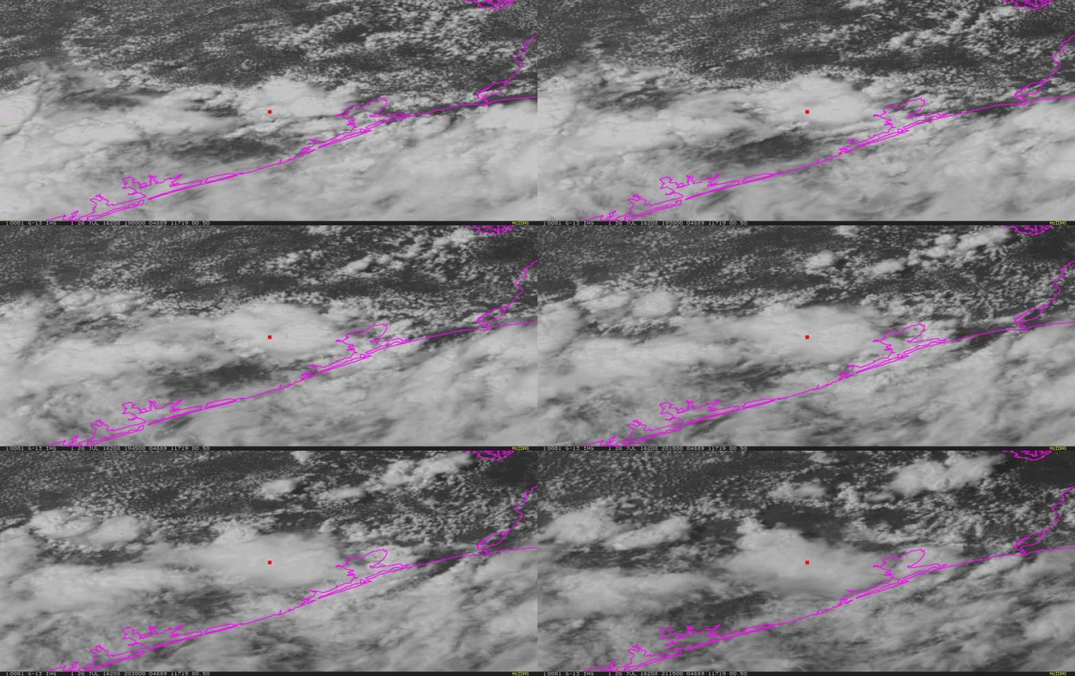
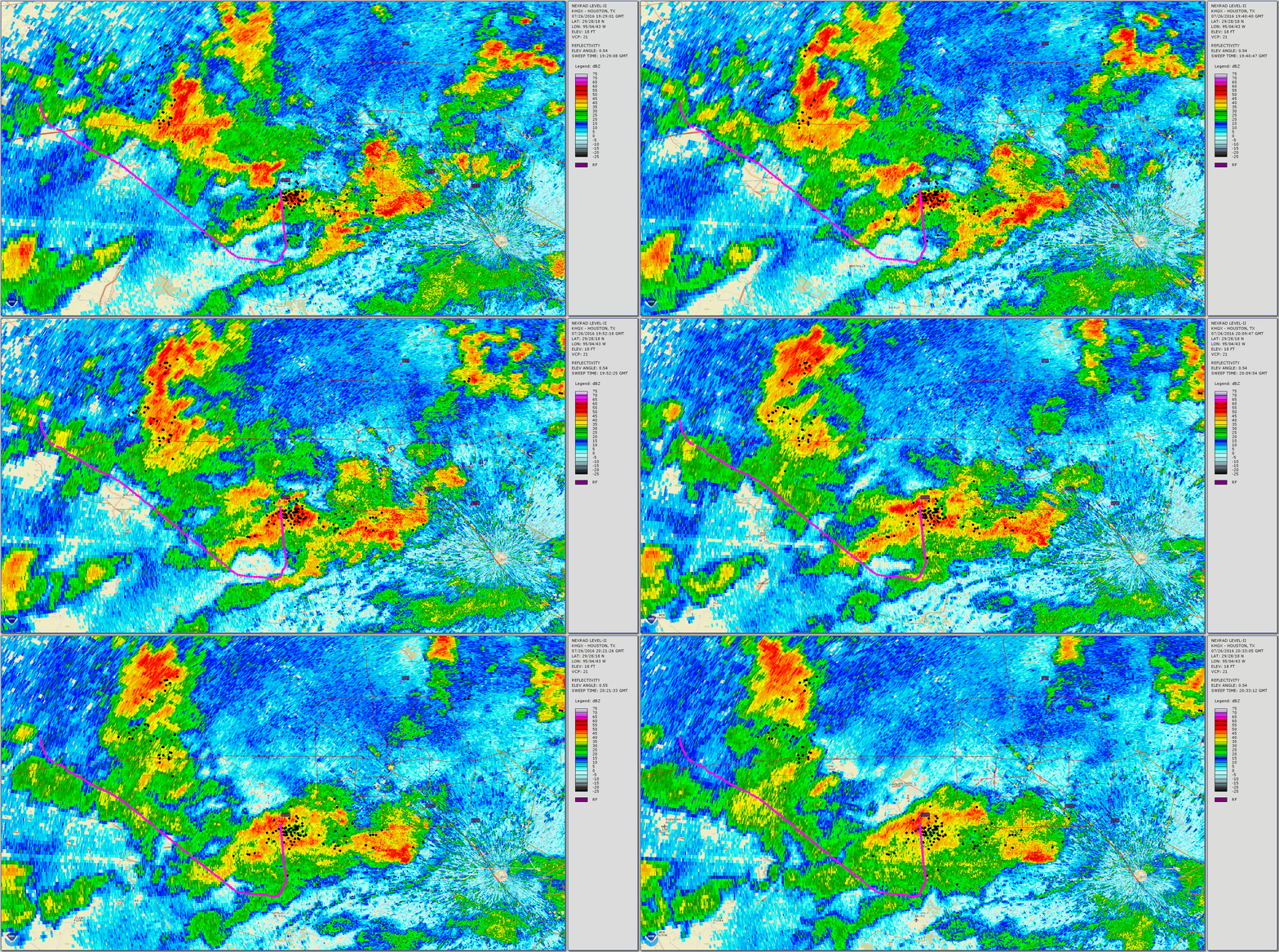
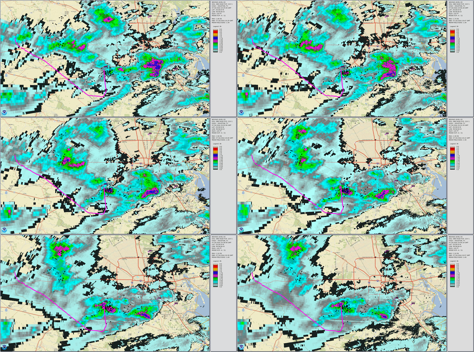
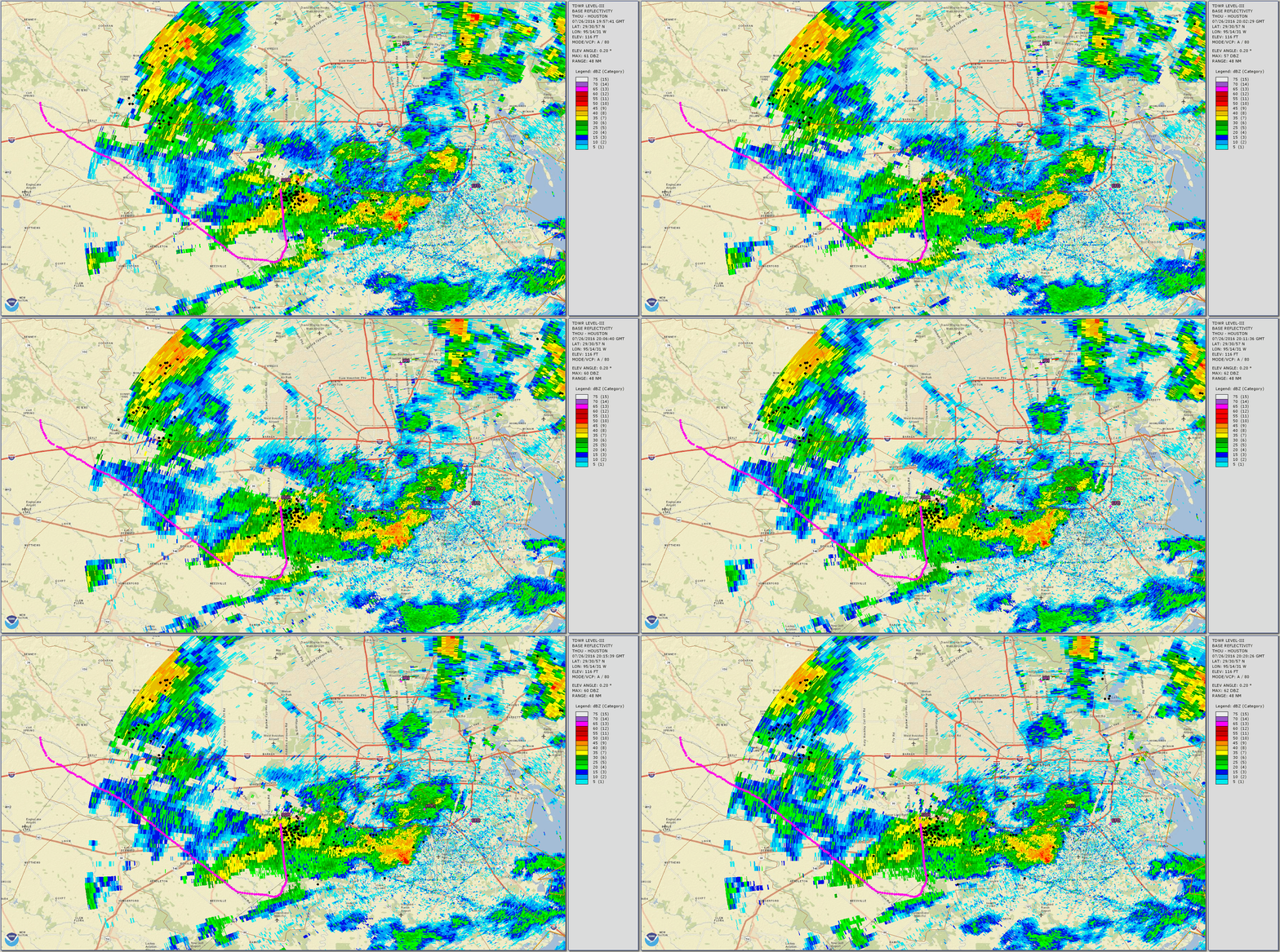
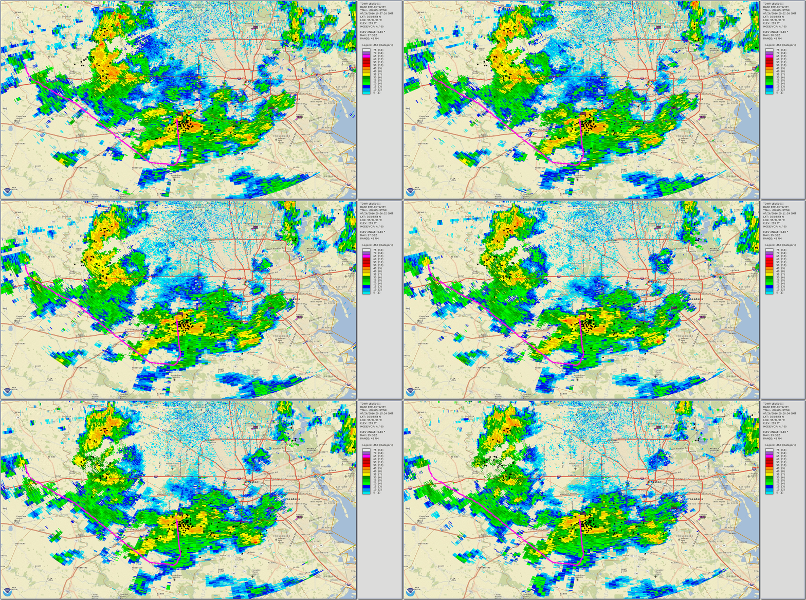
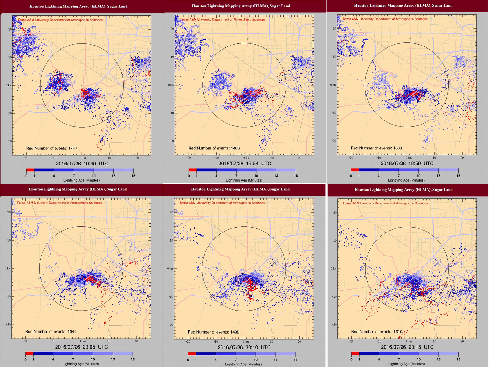
The pilot executed an instrument approach and landing in heavy rain. The airplane touched down about 21 knots above the applicable landing reference speed, which was consistent with an unstabilized approach. The airplane touched down near the displaced runway threshold about 128 kts, and both wing ground spoilers automatically deployed. The pilot reported that the airplane touched down “solidly,” and he started braking promptly, but the airplane did not slow down. The main wheels initially spun up; however, both wheel speeds subsequently decayed consistent with hydroplaning in the heavy rain conditions. When the wheel speeds did not recover, the brake control unit advised the flight crew of an anti-skid failure; the pilot recalled an anti-skid CAS message displayed at some point during the landing. The pilot subsequently activated the emergency brake system and the wheel speeds decayed. The airplane ultimately overran the departure end of the runway about 60 kts, crossed an airport perimeter road, and encountered a small creek before coming to rest. The wings had separated from, and were located immediately adjacent to, the fuselage. The pilot reported light to moderate rain began on final approach. Weather data and surveillance images indicated that heavy rain and limited visibility prevailed at the airport during the landing. Thunderstorms were active in the vicinity and the rainfall rate at the time of the accident landing was between 4.2 and 6.0 inches per hour. About 4 minutes before the accident, a surface observation recorded the visibility as 3 miles. However, 3 minutes later, the observed visibility had decreased to 3/8 mile. A review of the available information indicated that the tower controller advised the pilot of changing wind conditions and of better weather west of the airport but did not update the pilot regarding visibility along the final approach course or precipitation at the airport. The pilot stated that the rain started 2 to 3 minutes before he landed and commented that it was not the heaviest rain that he had ever landed in. The pilot was using the multifunction display and a tablet for weather radar, which showed green and yellow returns indicating light to moderate rain during the approach. He chose not to turn on the airplane’s onboard weather radar because the other two sources were not indicating severe weather. The runway exhibited skid marks beginning about 1,500 ft from the departure end and each main tire had one patch of reverted rubber wear consistent with reverted rubber hydroplaning. The main landing gear remained extended and both tires remained pressurized. The tire pressures corresponded to a minimum dynamic hydroplaning speed of about 115 kts. The airplane flight manual noted that, in the case of an antiskid failure, the main brakes are to be applied progressively and brake pressure is to be modulated as required. The emergency brake is to be used in the event of a brake failure; however, the pilotactivated the emergency brake when the main brakes still functioned; although, without anti-skid protection.
Factual narrative
According to the FAA Pilot’s Handbook of Aeronautical Knowledge, “dynamic hydroplaning is a condition in which the aircraft tires ride on a thin sheet of water rather than on the runway’s surface. Because hydroplaning wheels are not touching the runway, braking and directional control are almost nil. To help minimize dynamic hydroplaning, some runways are grooved to help drain off water; most runways are not. The minimum hydroplaning speed is determined by multiplying the square root of the main gear tire pressure in psi by nine.” According to the FAA Airplane Flying Handbook, “reverted rubber (steam) hydroplaning occurs during heavy braking that results in a prolonged locked-wheel skid. Only a thin film of water on the runway is required to facilitate this type of hydroplaning. The tire skidding generates enough heat to cause the rubber in contact with the runway to revert to its original uncured state. The reverted rubber acts as a seal between the tire and the runway and delays water exit from the tire footprint area. The water heats and is converted to steam, which supports the tire off the runway. Reverted rubber hydroplaning frequently follows an encounter with dynamic hydroplaning, during which time the pilot may have the brakes locked in an attempt to slow the airplane.” The Pilot’s Operating Handbook (POH) indicated that the unfactored landing distance for an airplane weighing 14,000 lbs with an operative anti-skid system, flaps 3 (landing configuration), a landing reference speed of about 107 kts, and a 10-knot tailwind was about 2,797 ft. The factored landing distance was about 5,367 ft for a wet runway condition and about 5,640 ft for a runway contaminated with 0.125” of standing water. The landing distance data contained in the POH was based on the anti-skid system being operative. The corresponding landing reference speed was about 107 kts. The main brake system was controlled by a brake-by-wire arrangement. Pilots independently commanded wheel brake pressure to either or both main wheel assemblies via position transducers installed on the rudder pedals. The transducers provided inputs to the BCU, which controlled the wheel brakes control and shutoff valves. The BCU incorporated locked wheel, antiskid, and touchdown protection. Locked wheel protection was designed to activate when a wheel speed was 30% less the reference velocity. When activated, the BCU reduced brake pressure to the slower wheel to zero allowing the wheel speeds to equalize. Antiskid protection, when activated, reduced brake pressure to recover wheel speed and prevent tire skidding. Touchdown protection prevented brake application until the airplane was on the ground or wheel spin-up occurred regardless of pedal inputs. Prolonged full dump (PFD) logic is initiated when the wheel speeds have not recovered following activation of the antiskid protection. Upon expiration of the PFD, the BCU will provide an antiskid fail CAS message if the wheel speeds have still notrecovered. In that situation, wheel braking would remain available; however, brake pressure would need to be modulated directly by the pilot. The emergency/parking brake, which was operated with a T-handle, which was mechanically linked to the emergency/parking brake valve and allowed the pilot to directly modulate brake pressure. Proper emergency braking consisted of pulling the emergency/parking brake handle with care. Braking would be initiated using very little handle displacement. Anti-skid protection was not available when using the emergency brake, and rapid emergency/parking brake actuation could lead to tire skidding. In case of an anti-skid failure, the main brakes are to be applied progressively until deceleration is felt and then brake pressure is to be modulated as required. The emergency brake is to be used in the event of a brake failure CAS message. The airplane was equipped with wing ground spoilers, which automatically deployed on landing. Runway 35 was 8,000 ft by 100 ft and constructed of concrete; it was not grooved. The runway 35 arrival threshold was displaced 1,984 ft. From the displaced threshold, 6,016 ft. was available for landing. The airport elevation was 82 ft. The ILS 35 approach procedure required a flight visibility of 3/4 mile for a straight-in landing and 1 mile for a circle-to-land maneuver. The depth of any standing water on the runway at the time of the accident was not available. However, airport surveillance video imagery depicted a water plume trailing behind the airplane during the landing rollout. On July 26, 2016, at 1510 central daylight time, an Embraer EMB-505 airplane, N362FX, was substantially damaged when it was involved in an accident near Sugar Land, Texas. The two airline transport pilots sustained minor injuries; the sole passenger was not injured. The airplane was operated as a Title 14 Code of Federal Regulations Part 135 corporate/executive flight. The flight approached Sugar Land Regional Airport (SGR) from the west, and the flight crew was provided radar vectors for the instrument landing system (ILS) approach to runway 35 at SGR. The controller advised the flight crew of “heavy to extreme precipitation” about 1 mile east of the runway extended centerline. The pilot-in-command reported that he flew the ILS approach to runway 35 and then transitioned to a visual approach. He recalled that light to moderate rain began on final approach about 2 or 3 minutes before landing and commented that it was not the heaviest rain he had ever landed in. The wind was from about 150° at 11 knots (kts) as they crossed the final approach fix. The airplane broke out of the clouds about 600 ft above ground level, and the runway was in sight at that time. The pilot landed “solidly” and started braking promptly; however, the airplane did not seem to slow down. The airplane was equipped with a flight data recorder (FDR) and a brake control unit (BCU), which captured system-related data. The FDR and BCU datarevealed that, during the landing, the main wheels began to spin up about 1509:53, and over the next 1.5 seconds, the left and right main wheel speeds increased to about 50 kts and 90 kts, respectively, before immediately decreasing to about 0 kts and 60 kts, respectively. About 1509:55, the weight-on-wheels parameter transitioned from air to ground. The airplane touched down about 200 ft beyond the displaced threshold about 128 kts ground speed. Both wing spoilers deployed at that time and remained extended for the duration of the available data. At that time, both wheel speeds began to increase again; however, about 1 second later, the right wheel speed started to decrease for a second time. In response to the decreasing wheel speed, the BCU immediately initiated a prolonged full dump (PFD) to the right wheel, which removed wheel brake pressure in an attempt to recover wheel speed and prevent skidding. The right wheel speed continued to decrease, and at 1509:57.5, the right wheel speed had decayed to 0 kts where it remained for the duration of the data. When the right wheel speed did not recover, the BCU simultaneously initiated an anti-skid-fail CAS message. The pilot recalled that the crew alerting system (CAS) system displayed an anti-skid message during the landing, but he did not recall exactly when. The left wheel speed increased to about 114 kts at 1509:59. However, the left wheel speed decreased again, and the BCU initiated a PFD to the left wheel brake at 1510:01. The left wheel speed subsequently decreased to 0 kts at 1510:02. At 1510:02, the pilot applied the emergency brake. The airplane ground speed was about 105 kts and about 2,600 ft of runway remained at that time. The pilot released the emergency brake momentarily at 1510:19 before applying it again at 1510:26 for the remainder of the data. Both wheel speeds subsequently decreased to and remained at 0 kts for the remainder of the data except for one short increase about 1510:29.5. About 1510:30, the airplane’s ground speed had decreased to 60 kts; the data ended at 1510:31.2 consistent with the inertia switch removing power from the FDR before the airplane came to a complete stop. The airplane ultimately departed the end of the runway, crossed an airport perimeter road, and encountered a small creek before coming to rest. The pilot indicated in a postaccident statement that, before the flight, he checked the weather via an online application, as well as Fltplan.com. En route weather data was also available on the airplane’s multifunction display (MFD) and on the pilot’s personal tablet. The radar returns displayed on the MFD were green and yellow, and the returns displayed on the tablet were all green. The pilot stated, however, that he was uncertain whether the depictions were real-time or delayed. The airplane was also equipped with onboard weather radar but it was not turned on during the accident flight because, according to the pilot, the other sources did not indicatesevere weather. The prevailing surface wind shifted from northwest to southeasterly about 1501, which was about 9 minutes before the accident. Thunderstorms were present in the vicinity of the airport. An abrupt change in surface wind direction and/or speed is consistent with the local thunderstorm activity. The SGR Automated surface observing system (ASOS) recorded wind, precipitation, and visibility data at one-minute intervals. According to the observations recorded at 1509, 1510 and 1511, the visibility was 3/8-mile in heavy rain. During that time, the two-minute average wind was from 152° to 154° at 10 to 11 knots and the five-second maximum average wind from 151° to 159° at 12 to 16 knots. The SGR Meteorological Aerodrome Report (METAR) observations indicated that 0.70 inches of rain fell between 1506 and 1517. Based on the one-minute observations, the rainfall rate was between 4.2 and 6.0 inches per hour at the time the airplane was landing. Airport surveillance camera imagery recorded about the time of the accident was consistent with the METAR observations. The SGR tower controller advised the pilot of changing wind conditions and of better weather conditions west of the airport. However, the controller did not update the pilot regarding visibility along the final approach course or precipitation at the airport. Airport Information Airport: Sugar Land Regional SGR Runway Surface Type: Concrete Airport Elevation: 82 ft msl Runway Surface Condition: Wet Examination of the runway environment revealed no skid marks attributable to the accident airplane until about 1,500 ft from the departure end, in the vicinity of the taxiway H intersection, where distinct tire marks were visible. The marks were lighter than the adjacent runway pavement and appeared consistent with steam generated marks due to reverted rubber hydroplaning. The marks tracked right of the runway centerline. A track consistent with being formed by the nose wheel drifted right and then left outside of the main wheel tracks. The tire marks continued to the end of the runway pavement, into a grass area at the end of the runway, and across an airport access road. The marks continued as depressions in the grass. Scrape marks on the road were consistent the nose wheel separating from the strut at the edge of the road. The nose wheel was not recovered. The left and right main landing gears remained extended at the accident site. Both exhibited mud and vegetation consistent with the runway excursion. Visual examination did not reveal any anomalies associated with the gear or brake system components. The left and right main landing gear tires remained pressurized at 175 psi and 165 psi, respectively; exhibited about 3/8-inch of tread depth; and appeared to each have one area of reverted rubber wear. The airplane came to rest on the opposite side of a small creek running along the access road. The wings had separated from, and were located immediately adjacent to, the fuselage. Theempennage and engines remained attached to the aft fuselage.
Aircraft
- Registration
- N362FX
- Reported as
- Embraer EMB-505
- Category
- Airplane
- Serial number
- 50500239
- Built
- 2014
- Airframe hours
- 1,880
- Engines
- Pratt & Whitney Canada PW535E, 3,360 lbs thrust, turbo fanPratt & Whitney Canada PW535E, 3,360 lbs thrust, turbo fan
- Damage
- Substantial damage
- Flight
- Part 135
- Operator
- Flight Options LLC
- Registered owner
- Flexjet LLC
- Airworthiness certificate
- Standard, Commuter
- Last inspection
- Continuous airworthiness · July 3, 2016 · 59 hours before
- Departed
- SDL · Scottsdale, AZ
- Destination
- SGR · Sugar Land, TX
- Flight plan
- IFR
- Airport
- SGR · Sugar Land Regional, runway 35, 8,000 × 100 ft, concrete
- Equipment
- Electronic multifunction display, Electronic primary flight display, Onboard weather, Satellite tracking device, Stall warning system, Auto-pilot, Data recorder, Electronic flight bag or handheld device
Matched to the registry by N-number and the event date; the registry’s history has gaps, so older matches can be wrong. Compare the reported make and model.
Flight crew · 2
As NTSB recorded them. NTSB leaves out names.
- Role
- Pilot
- Age
- 43
- Injuries
- Minor
- Certificates
- Flight instructor, Airline transport
- Airplane ratings
- Single-engine land, Multi-engine land
- Instrument ratings
- Airplane
- Medical
- Class 1, With waivers/limitations
- Last flight review
- April 22, 2016
- Seat
- Left
- Restraint
- 5-point
- Flight hours
- 9,246 total · 1,358 in this make and model · 143 in the last 90 days · 38 in the last 30 days
- Role
- Co-pilot
- Age
- 59
- Injuries
- Minor
- Certificates
- Airline transport, Flight instructor
- Airplane ratings
- Single-engine land, Multi-engine land
- Instrument ratings
- Airplane
- Medical
- Class 1, Without waivers/limitations
- Last flight review
- December 11, 2015
- Seat
- Right
- Restraint
- 5-point
- Flight hours
- 11,362 total · 962 in this make and model · 152 in the last 90 days · 75 in the last 30 days
Weather
- Conditions
- Visual (VMC) · Day
- Wind
- 130° at 8 knots
- Visibility
- 3 statute miles
- Lowest ceiling
- 1,300 ft broken
- Temperature
- 75 °F, dew point 73 °F
- Altimeter
- 29.94 inHg
- Observed at
- SGR, 1 nm away
Docket · 43
The files NTSB released with the investigation on May 28, 2021, on NTSB’s docket system: statements, records, photos and specialists’ reports. 647 MB in all.

FAA reports on this event · 1
The FAA’s own accident and incident reports, matched to the aircraft by N-number and date.